Multi-image Texture Mapping
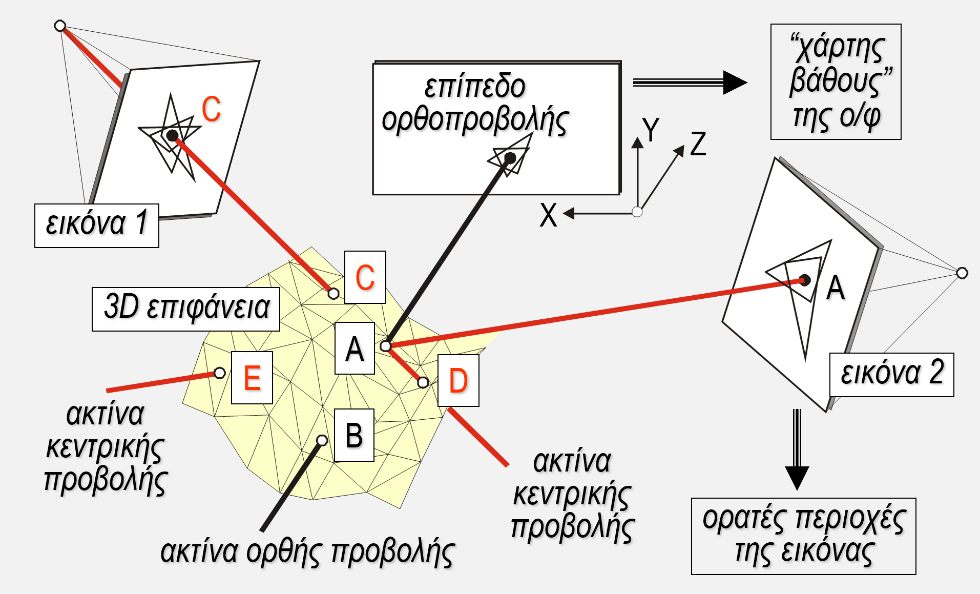
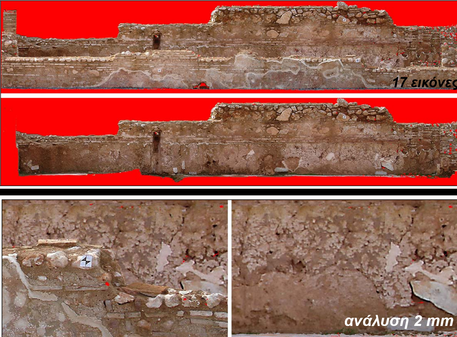
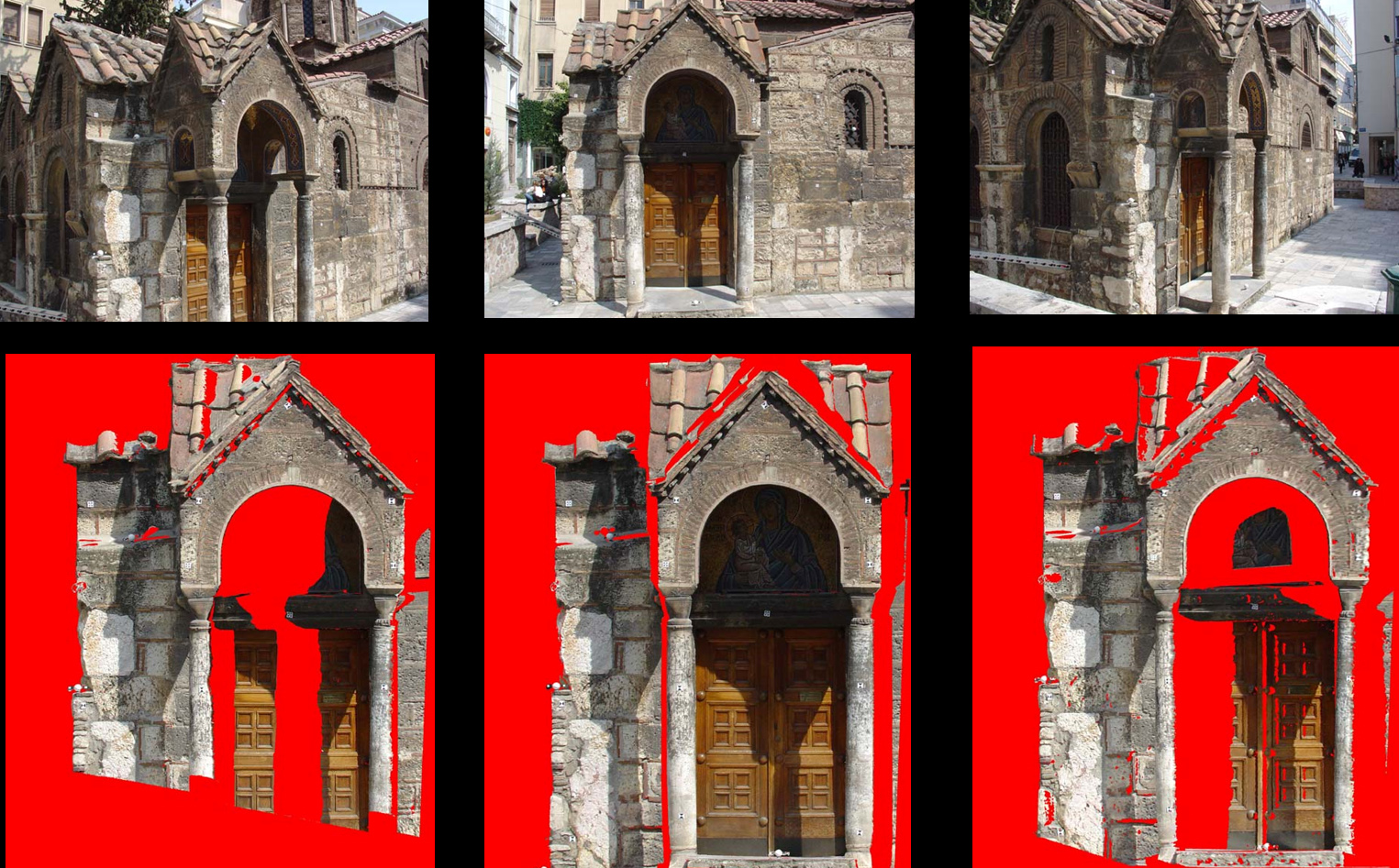
Terrestrial laser scanning has become a standard tool for 3D surface modeling. To fully leverage 3D data in the process of texture mapping or generating large-scale true orthophotos, a fully automated algorithm was developed. This algorithm addresses occlusion issues caused by the surfaces themselves and the images, while integrating texture from multiple images..
All surface points that are visible from a given viewing direction (vertical, oblique, etc.) are automatically detected in an initial step. Then, the textures from all images that capture each specific surface point are combined. Additionally, different methods are provided to automatically remove extreme colors from individual images, especially near the edges of occlusions.
Publications
-
2007: Laser scanning and automatic multi-image texturing of surface projections.
XXI CIPA International Symposium, Athens, 1–6 October, pp. 579–584 -
2007: Automatic multi-view texture mapping of 3D surface projections.
3D-ARCH '07, ETH Zurich -
2007: Ανάπτυξη Αλγορίθμων για την Αυτόματη Παραγωγή Φωτορρεαλιστικών Μοντέλων Ακριβείας.
Τελική Τεχνική Έκθεση, ΕΠΕΑΕΚ “ΑΡΧΙΜΗΔΗΣ ΙΙ” -
2007: Generation of orthoimages and perspective views with automatic visibility checking and texture blending.
Photogrammetric Engineering & Remote Sensing, 73(4), pp. 403–411 -
2005: Data fusion from multiple sources for the production of orthographic and perspective views.
XX CIPA Int. Symposium, Torino, pp. 819–824 -
2004: Automatic multi-image photo-texturing of 3D surface models obtained with laser scanning.
CIPA Workshop, Lisbon -
2004: On automatic orthoprojection and texture-mapping of 3D surface models.
ISPRS Archives, 35(5), pp. 360–365