Processing and 3D Modeling of Archaeological Scans
Summary
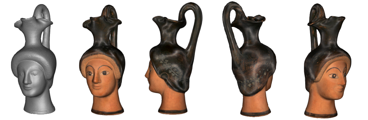
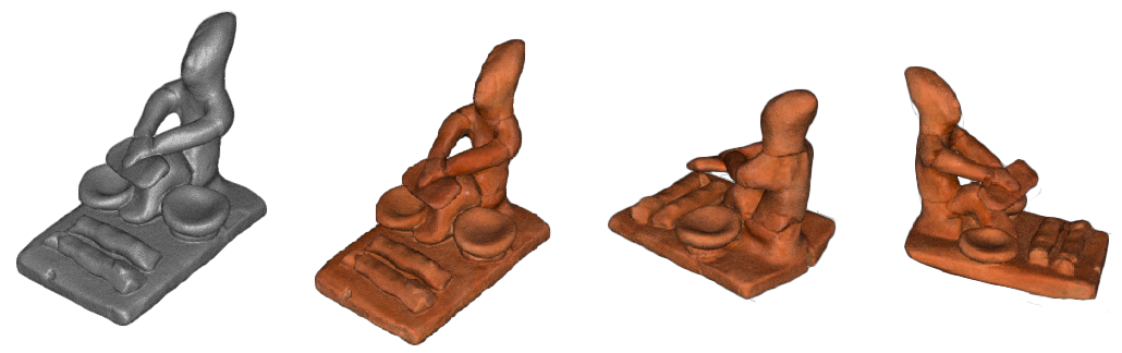
The project involved the creation of 3D digital models of exhibits from the Archaeological Museum of Polygyros. The process included scanning with a handheld scanner (Visual SLAM), point cloud processing, and polygon mesh generation. Textures were applied using photogrammetric methods for photorealistic visualization. The final result consisted of three-dimensional models suitable for study and digital presentation.
Goal
The main goal of the project was to digitally preserve and showcase the exhibits of the Archaeological Museum of Polygyros through the creation of detailed 3D models. This involved not only capturing the geometry of the artifacts but also ensuring that their textures and visual qualities were faithfully represented.
To achieve this, the project aimed to:
Produce accurate 3D digital representations of archaeological objects using handheld scanning (Visual SLAM).
Process raw scan data through point cloud refinement and polygon mesh generation to create precise geometrical structures.
Apply photorealistic textures using photogrammetry in order to enhance realism and visual impact.
Ultimately, the project sought to deliver high-quality 3D models suitable for research, study, and digital presentation, thereby contributing to both cultural heritage preservation and public accessibility.
Methodology
The development of the 3D models followed a structured workflow designed to ensure both geometric accuracy and visual realism. The process began with data acquisition, where the physical exhibits were scanned using an Artec Leo handheld 3D scanner (Visual SLAM technology). This step allowed for the precise capture of the artifacts’ geometry in a portable and flexible way.
Once the raw scans were collected, the focus shifted to data processing. The point clouds were carefully registered, cleaned, and aligned to remove noise and inconsistencies. From these refined datasets, polygon meshes (3D surfaces) were generated, forming the foundation of the digital models.
The next step was texture mapping, where photorealistic textures were integrated onto the polygon meshes. This ensured that not only the geometry but also the surface details and appearance of the artifacts were faithfully reproduced.
Data Acquisition: Scanning with Artec Leo handheld 3D scanner (Visual SLAM).
Data Processing: Point cloud registration, cleaning, alignment, and mesh generation.
Texture Mapping: Application of high-quality textures for photorealistic visualization.
Finally, the methodology concluded with the production of fully textured 3D models. These digital replicas were validated to be suitable for study, research, and digital presentation, fulfilling both scientific and cultural heritage objectives.